Potential Weather Shifts Brewing in the Luzon Sea and South China Sea
Weather watchers and residents across southern China and Taiwan should stay alert as the Observatory forecasts an intriguing low-pressure system developing in the coming days. This atmospheric phenomenon promises to bring potentially significant meteorological changes to the region.
The developing low-pressure area is expected to emerge near Luzon over the weekend and into early next week, with meteorologists emphasizing the system’s highly unpredictable nature. Current computer forecast models are showing considerable variations in predicting both the system’s development and potential trajectory, highlighting the complex dynamics at play.
Several environmental conditions are creating a conducive environment for this potential weather system. Sea water temperatures in the region are particularly favorable for low-pressure area formation, while weakened vertical wind shear and upper atmosphere divergence are providing additional supportive conditions. These technical factors suggest the possibility of a more substantial weather event taking shape.

The potential paths for this low-pressure system present two primary scenarios. In one scenario, the system could enter the South China Sea and move towards the coast of southern China during the middle to late part of next week. This route might bring stronger winds and increased shower activity to coastal regions. Alternatively, the system could turn towards Taiwan in the northwest Pacific, which would likely result in weaker local winds and continued high temperatures.
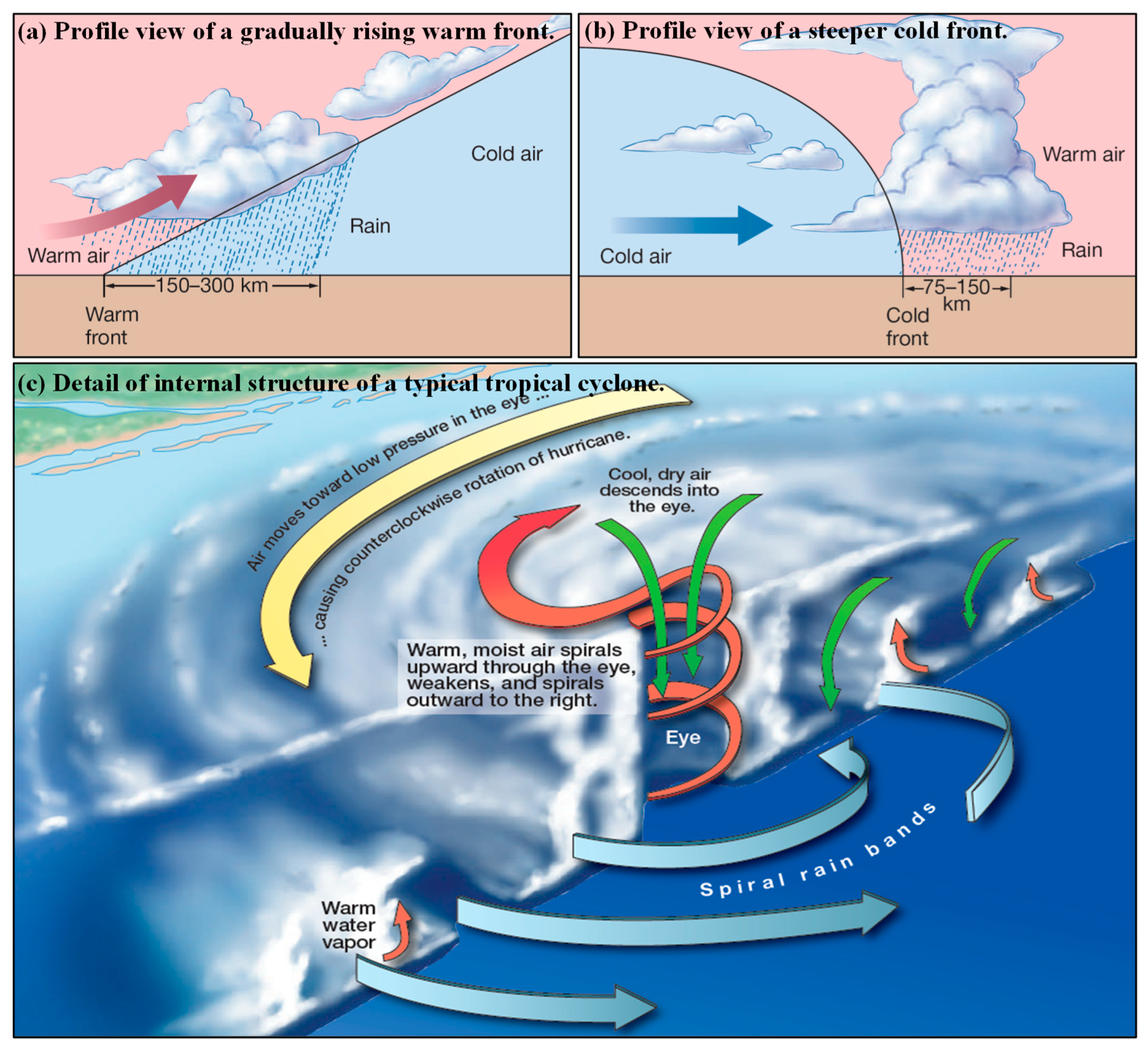
If the system intensifies sufficiently, it could potentially develop into a tropical storm. Should this occur, it would be designated with the name “Butterfly” and would mark the first tropical cyclone in the northwest Pacific and South China Sea for the year 2025.
Residents and travelers in the affected regions are advised to stay informed about the latest weather updates. The variability in the system’s potential movement underscores the importance of monitoring official meteorological communications and being prepared for possible weather changes.
The Observatory’s careful tracking and analysis demonstrate the complexity of predicting atmospheric systems. The significant differences among computer forecast models reveal the challenging nature of meteorological predictions, especially in regions with dynamic maritime and atmospheric conditions.
While the immediate focus remains on the potential low-pressure system, this forecast serves as a reminder of the intricate and sometimes unpredictable nature of weather patterns. The interplay of sea temperatures, wind patterns, and atmospheric conditions creates a dynamic environment where multiple scenarios can unfold.
For those interested in understanding these meteorological developments, paying attention to official updates from the Observatory will provide the most current and accurate information. The coming days will be crucial in determining the exact path and intensity of this developing weather system.
As always, local communities are encouraged to stay prepared, remain informed, and follow any guidance or recommendations issued by local meteorological authorities. Weather systems like these highlight the fascinating and sometimes unpredictable nature of our planet’s atmospheric dynamics.