Tropical Storm Tapah Approaches: Hong Kong Prepares for Potential Disruption
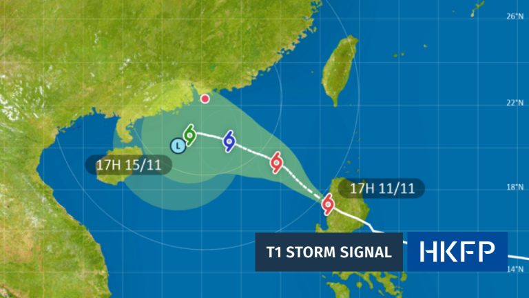
As Sunday evening approaches, Hong Kong residents are bracing themselves for the imminent arrival of Tropical Storm Tapah, with the Hong Kong Observatory taking decisive action to protect public safety. The meteorological authority has announced the issuance of the Gale or Storm Signal No. 8 (T8) at precisely 9:20 PM, signaling the storm’s significant potential to impact the region.

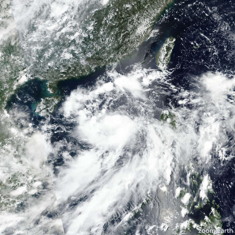
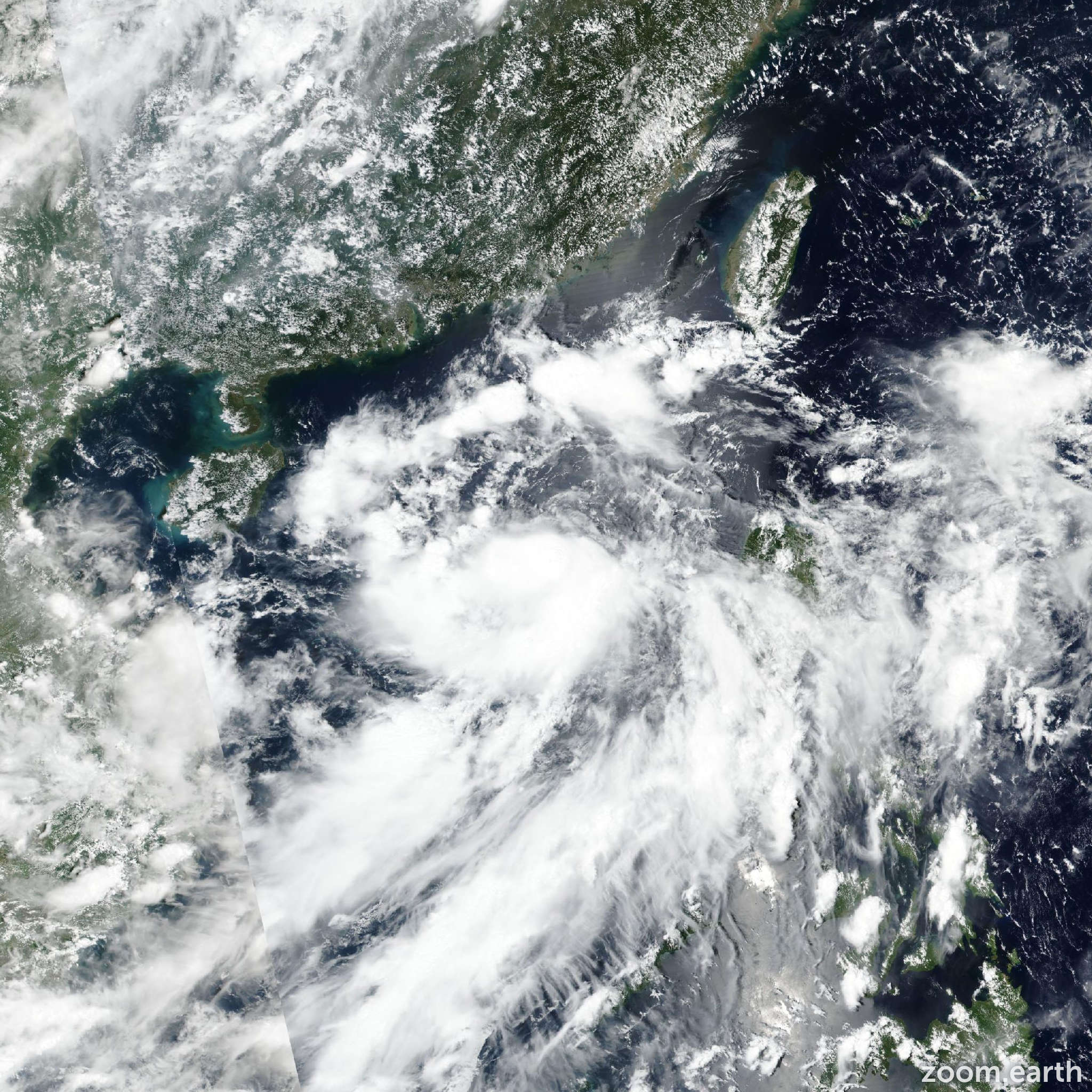
Currently tracking approximately 290 kilometers south of Hong Kong, Tapah is moving steadily northwest at a speed of about 18 kilometers per hour. The storm’s trajectory suggests it will pass within 200 kilometers southwest of Hong Kong around sunrise on Monday, before making landfall in western Guangdong. Meteorologists predict the T8 signal will remain in force until at least 11:00 AM on Monday, September 8, indicating a prolonged period of potentially severe weather conditions.

The approaching storm is expected to bring substantial meteorological challenges. Residents can anticipate occasional squally showers and thunderstorms, particularly along the Guangdong coast. As Tapah continues to approach, the intensity is forecasted to gradually increase, promising a dramatic display of nature’s power. Monday morning is likely to be particularly turbulent, with heavy squally showers accompanied by strong winds and rough seas.
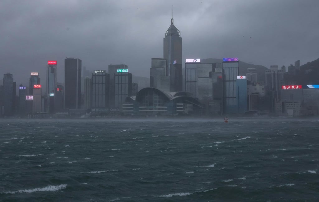
One of the most significant concerns is the potential for coastal flooding. The storm surge presents a real risk to low-lying coastal areas, creating potential hazards for residents and infrastructure. This threat underscores the importance of staying informed and following official guidance during extreme weather events.

In response to the impending storm, local authorities have already taken proactive measures. The Education Bureau has made the decision to suspend evening school classes on Sunday night, prioritizing student and staff safety. This preemptive action reflects the serious approach to public safety during potentially dangerous weather conditions.
For Hong Kong residents, preparation is key. Staying updated on weather developments, following official announcements, and taking necessary precautions can make a significant difference in personal safety. The Hong Kong Observatory continues to monitor Tapah’s progress closely, providing real-time updates to help residents make informed decisions.
While the storm presents challenges, it also demonstrates the city’s robust emergency preparedness system. The systematic approach to issuing storm signals, coordinating public safety measures, and communicating critical information reflects Hong Kong’s resilience in the face of natural challenges.
As Tapah continues its approach, residents are advised to remain vigilant, stay informed, and prioritize personal safety. The coming hours will be crucial in determining the full extent of the storm’s impact, with the potential for significant disruption to daily life.
The situation remains dynamic, and conditions can change rapidly. Keeping a close eye on official communications from the Hong Kong Observatory and local authorities will be essential for navigating the potential challenges posed by Tropical Storm Tapah.