Introduction: Overview of Typhoon Podul and Its Significance
Typhoon Podul is a tropical cyclone currently affecting parts of southern China and Taiwan. This storm is important because it brings very hot weather, heavy rain, and strong winds to these areas. Understanding Podul’s path and effects can help people stay safe and prepare for the changes in weather. Let’s look at what’s happening with this storm and what to expect in the coming days.
Tracking Typhoon Podul: Formation, Movement, and Intensity
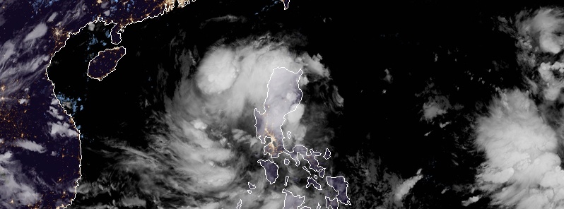
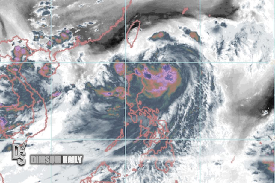
Typhoon Podul is moving west across the southern part of Taiwan right now. It is getting stronger as it moves. After crossing Taiwan, it will hit land again near eastern Guangdong and southern Fujian in China. As it moves over land, Podul will start to weaken. However, before it weakens, it will bring heavy rain and strong winds to the areas in its path. Keeping track of Podul’s movement helps weather experts warn people in time.
Regional Impacts of Typhoon Podul on Taiwan and Southern China
In southern China, the weather will be very hot tomorrow because of the sinking air around Podul. This heat will also cause showers in the area. As Podul moves closer, coastal areas of Guangdong will face heavy rain, strong winds, and thunderstorms on Thursday and Friday. There will also be big waves, called swells, along the coast. In Taiwan, southern areas will feel the storm’s effects as it passes through with rain and wind. These weather changes can cause flooding or damage, so people need to be ready.
Preparing for the Storm: Necessary Precautions and Safety Measures
If you live in an area affected by Podul, there are some simple steps to stay safe. First, listen to weather updates on the radio, TV, or online to know when the storm will hit. Secure loose items outside your home, like chairs or trash cans, so they don’t blow away. Stock up on food, water, and batteries in case power goes out. If you live near the coast, be ready for flooding and avoid going near the water during big waves. Staying inside during the worst of the storm is the best way to stay safe.
The Aftermath and Recovery: What to Expect Post-Landfall
After Podul makes landfall in eastern Guangdong and southern Fujian, it will start to weaken. By the weekend, the storm will move away, and the weather in southern China should get better. A stronger high-pressure system will bring clearer skies. However, there might still be some damage from rain or wind, like fallen trees or flooded roads. People will need to clean up and check their homes for any problems. Help from local leaders or emergency teams may be available if things are really bad.
Climatological Context: Understanding the Larger Picture
Podul is just one part of bigger weather patterns in the region. After the storm leaves, a new area of low pressure might form over the South China Sea during the weekend or early next week. This could move north and bring more rainy, unsettled weather to western Guangdong and nearby areas like Beibu Wan. Weather systems like these are common in this part of the world during this time of year. Knowing about them helps us understand why storms like Podul happen and what might come next.
Conclusion: Summary and Future Outlook
Typhoon Podul is bringing hot weather, heavy rain, and strong winds to southern China and Taiwan right now. It will hit land soon and then weaken, with better weather expected by the weekend. But more rainy weather might come after that due to a new low-pressure area. Staying informed and prepared is the best way to handle these changes. Keep watching for updates to know what to do next.