Introduction
Right now, an anticyclone, which is a high-pressure system in the upper atmosphere, is affecting the weather in Southern China. This system is bringing mostly clear and fine weather to the area for the next couple of days. However, it’s also causing very hot temperatures. While the weather will be nice at first, showers are expected in some inland areas due to the heat. Later, other weather systems will bring more rain and storms to the region. Let’s break down what this means and what to expect.
Current Weather Setup
Because of the anticyclone above Southern China, the weather is generally calm and sunny right now. Winds are weak, so there’s not much breeze to cool things down. This is why temperatures are climbing so high. The heat is sticking around, especially in cities and towns across the region. However, in inland areas, away from the coast, the high temperatures are causing the air to rise and form rain clouds. This means some places will see short bursts of rain or showers, even if the rest of the day is sunny.
![]()
Anticipated Heatwave and Inland Showers
The heatwave in Southern China is going to be intense over the next few days. Temperatures could feel very uncomfortable, especially in crowded areas or places without much shade. This kind of heat can make people feel tired, dizzy, or sick if they’re outside too long. It’s important to stay hydrated and avoid the hottest parts of the day. Inland areas, like parts of Guangxi and Hunan, are most likely to get showers because the heat causes moisture in the air to turn into rain. These showers might be quick but could still make roads slippery or cause small floods in low spots.
![]()
Upper-Air Disturbance Impact
Early next week, a different weather system called an upper-air disturbance will move in. This is a change in the air high above the ground that can create unstable weather. For the coast of Guangdong, this means showers and thunderstorms are on the way. These storms could bring heavy rain, lightning, and strong winds for a short time. People in coastal towns should be ready for sudden weather changes and keep an eye on local warnings. The rain might help cool things down a bit, but it could also make travel tricky.

Broad Trough of Low Pressure
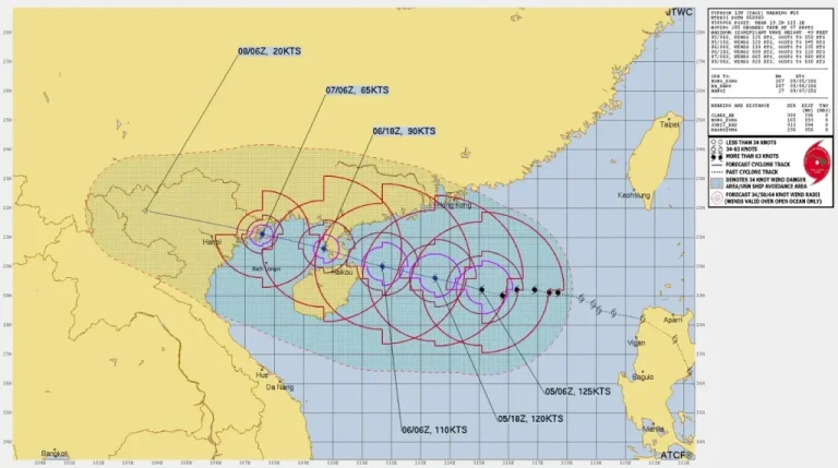
Meanwhile, a big area of low pressure, called a broad trough, is forming over the South China Sea and the seas east of the Philippines. This system could turn into a stronger low-pressure area over time. Right now, it’s bringing unsettled weather, like rain and clouds, to central and northern parts of the South China Sea. As this trough moves north, it will get closer to Southern China. This means the weather in the region will likely change, with more rain expected as the week goes on.
Mid to Late Week Outlook
By the middle and end of next week, the broad trough of low pressure will be near the coast of Southern China. This will bring more showers and possibly heavier rain to the area. Coastal areas, like Guangdong, might see more rain than inland spots at first, but eventually, most of the region will get wet. Inland areas could still have some heat, but the rain will become more common everywhere. It’s a good idea to keep checking weather updates because this system could change quickly and bring stronger storms.
Conclusion and Recommendations
To sum up, Southern China is starting with hot, mostly fine weather due to an anticyclone, but showers will pop up inland because of the heat. Early next week, an upper-air disturbance will bring storms to the coast, and later, a trough of low pressure will increase rain across the region. To stay safe, drink plenty of water and avoid being outside during the hottest times. If you’re in an area expecting rain or storms, have an umbrella or raincoat ready and watch for warnings about flooding. For the latest updates, check local weather apps or news channels to know what’s happening in your area.


