Introduction: Understanding the Dual Weather Threats in Southern China
Southern China is facing two big weather events right now. First, a strong anticyclone, which is a high-pressure system in the upper atmosphere, will bring very hot weather in the next few days. Second, Tropical Cyclone Podul is growing stronger and moving toward areas near Taiwan and eastern China. These two weather patterns will affect different parts of the region with heat, heavy rain, and storms. Let’s break down what’s happening and what to expect.
Detailed Explanation of the Anticyclone and Its Impact on Extreme Heat
An anticyclone is a weather system where air sinks down from high up in the sky. When this happens, it stops clouds from forming and makes the weather sunny and hot. Right now, an anticyclone aloft, meaning high in the atmosphere, is over southern China. This will cause temperatures to rise a lot over the next couple of days. People in this area should stay hydrated, avoid being outside during the hottest parts of the day, and use fans or air conditioning to stay cool.
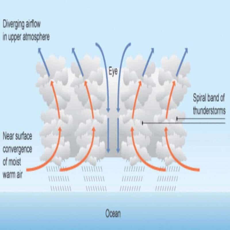
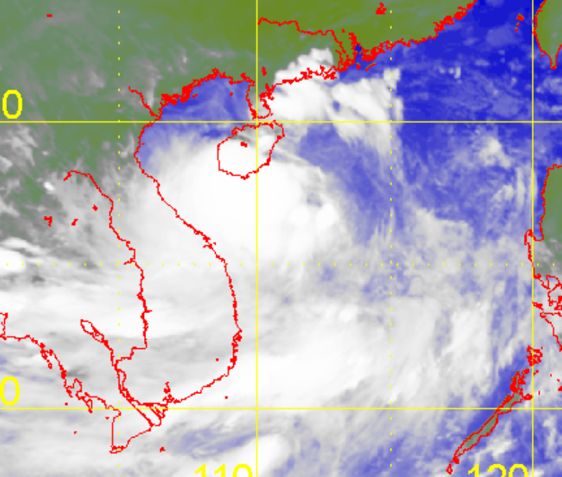
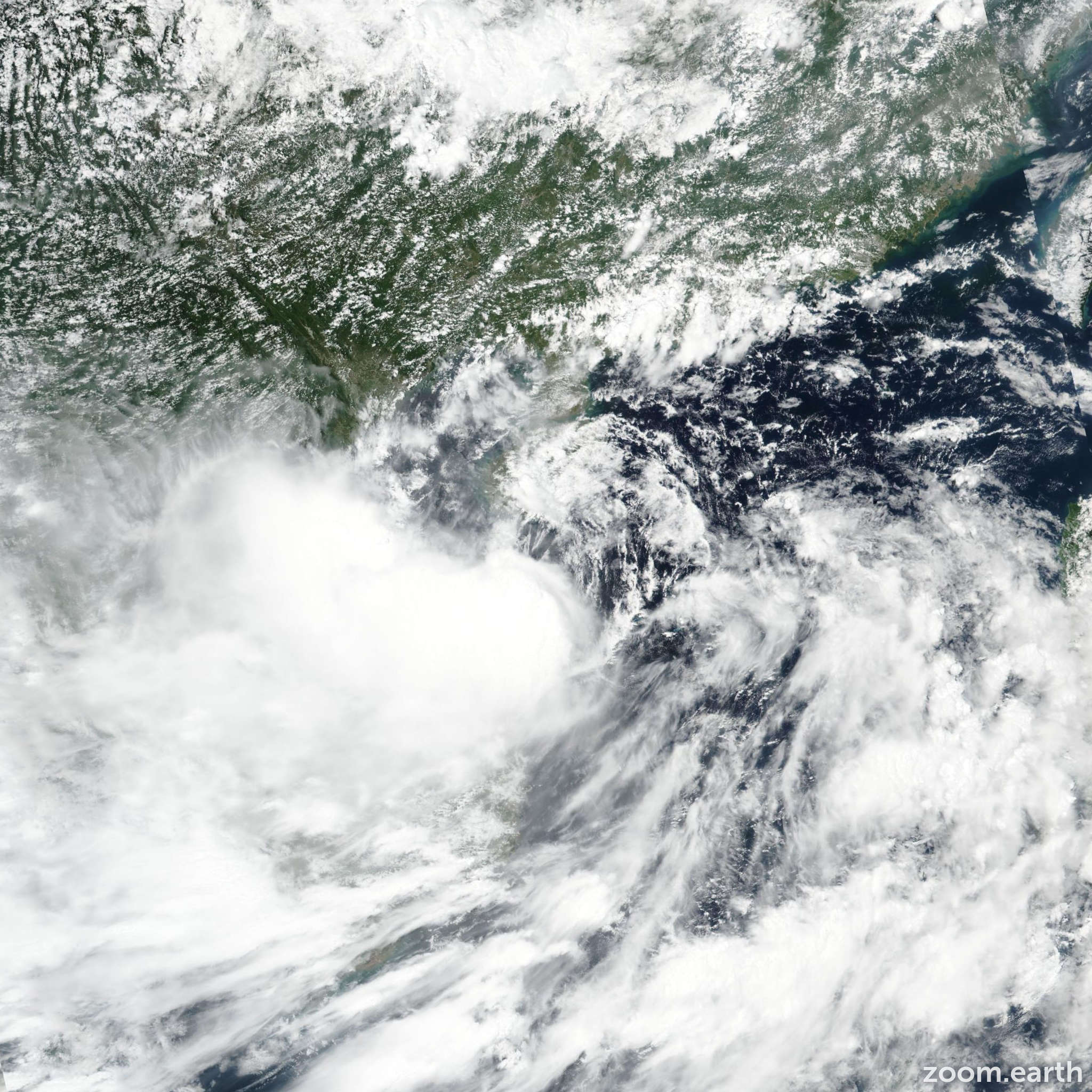
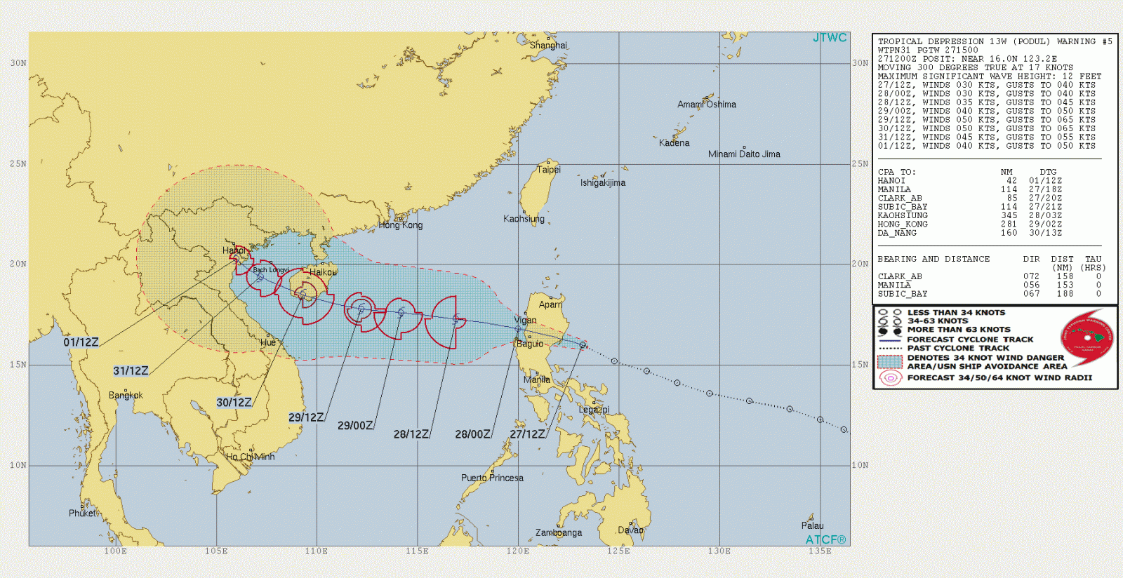
Breakdown of Tropical Cyclone Podul’s Movement and Intensification
Tropical Cyclone Podul is a storm forming over the ocean. It is getting stronger as it moves west toward the area near Taiwan. After that, it will likely head closer to eastern Guangdong and southern Fujian in China. Right now, experts aren’t sure exactly where it will hit land or how strong it will be when it does. This makes it important for people in these areas to keep checking weather updates and prepare for possible strong winds and rain.
Regional Impacts of Podul’s Heavy Rain and Thunderstorms
As Tropical Cyclone Podul gets closer, it will bring heavy showers and squally thunderstorms to Guangdong. This means there could be a lot of rain in a short time, which might cause flooding in some places. Thunderstorms could also bring strong winds and lightning. This bad weather is expected to hit in the middle and later parts of this week. People should avoid low-lying areas, secure loose items outside, and be ready for power outages or travel delays.
Uncertain Landfall Scenarios and Associated Risks
Since experts don’t know exactly where Podul will make landfall, there are a few risks to think about. If it hits near a big city, it could cause more damage and affect more people. If it stays over the ocean longer, it might get stronger before hitting land. Coastal areas could see high waves and storm surges, which are big rises in sea level caused by the storm. Everyone in the possible path should stay alert and follow local warnings.

Overview of Weather Improvement Post-Podul and Anticyclone Strengthening
After Tropical Cyclone Podul moves away, the weather in southern China should get better over the weekend. The anticyclone aloft will get stronger, which means more sunny and hot days. The rain and storms from Podul will stop, and people can expect clearer skies. However, the heat will still be a concern, so keep taking steps to stay cool and safe.
Northern South China Sea Weather Outlook for Next Week
Looking ahead to early next week, a broad trough of low pressure will move into the northern part of the South China Sea. A trough is an area of lower pressure that often brings unsettled weather. This means more rain and possibly storms could return to the area. People in this region should keep an eye on forecasts to see how this weather system develops and plan for wet conditions again.
Conclusion: Balancing Extreme Heat and Stormy Weather in the Region
Southern China is dealing with two very different weather challenges right now: extreme heat from an anticyclone and heavy rain from Tropical Cyclone Podul. Both can be dangerous in their own way, so it’s important to stay prepared. Keep up with weather updates, protect yourself from the heat, and get ready for possible storms. By staying informed, you can stay safe during this tricky weather period.