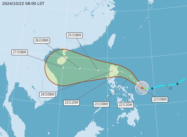
As southern China braces for another potential weather disruption, Tropical Cyclone Bualoi emerges as the latest storm to command meteorological attention this September. Forming on Tuesday morning east of the Philippines, this tropical storm represents the 20th cyclone of the year and signals an intensely active storm season in the Western Pacific.
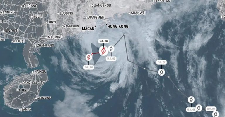
The Hong Kong Observatory and China Meteorological Administration are closely tracking Bualoi’s trajectory, which currently positions the storm approximately 1,420 kilometers southeast of Manila. With sustained winds reaching 18 meters per second (65 km/h) and a wind force radius of 100 kilometers, the storm carries significant meteorological weight. Its current pressure stands at 1000 hPa, indicating a robust atmospheric system capable of substantial environmental impact.

Bualoi’s projected path suggests a westward movement across the Philippines and into the eastern South China Sea, with potential intensification anticipated as it approaches waters near Hainan Island by September 27-28. This weekend timeframe presents a critical window for monitoring, as the storm may come within 800 kilometers of Hong Kong—close enough to warrant careful observation but not yet guaranteeing direct landfall.

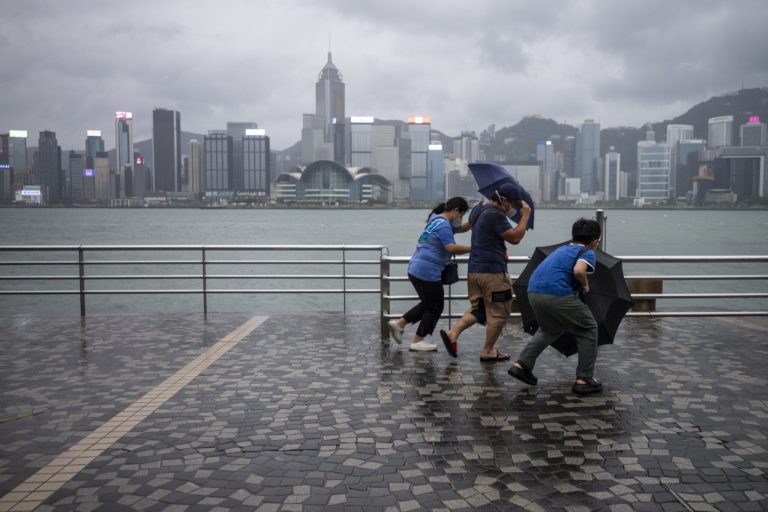
The current weather scenario follows the recent passage of Super Typhoon Ragasa, which previously disrupted western Guangdong with severe thunderstorms, strong winds, and significant storm surges. While Hong Kong’s immediate forecast promises brief meteorological respite with reduced rainfall and clearer skies, Bualoi’s approach introduces renewed uncertainty to the region’s weather stability.
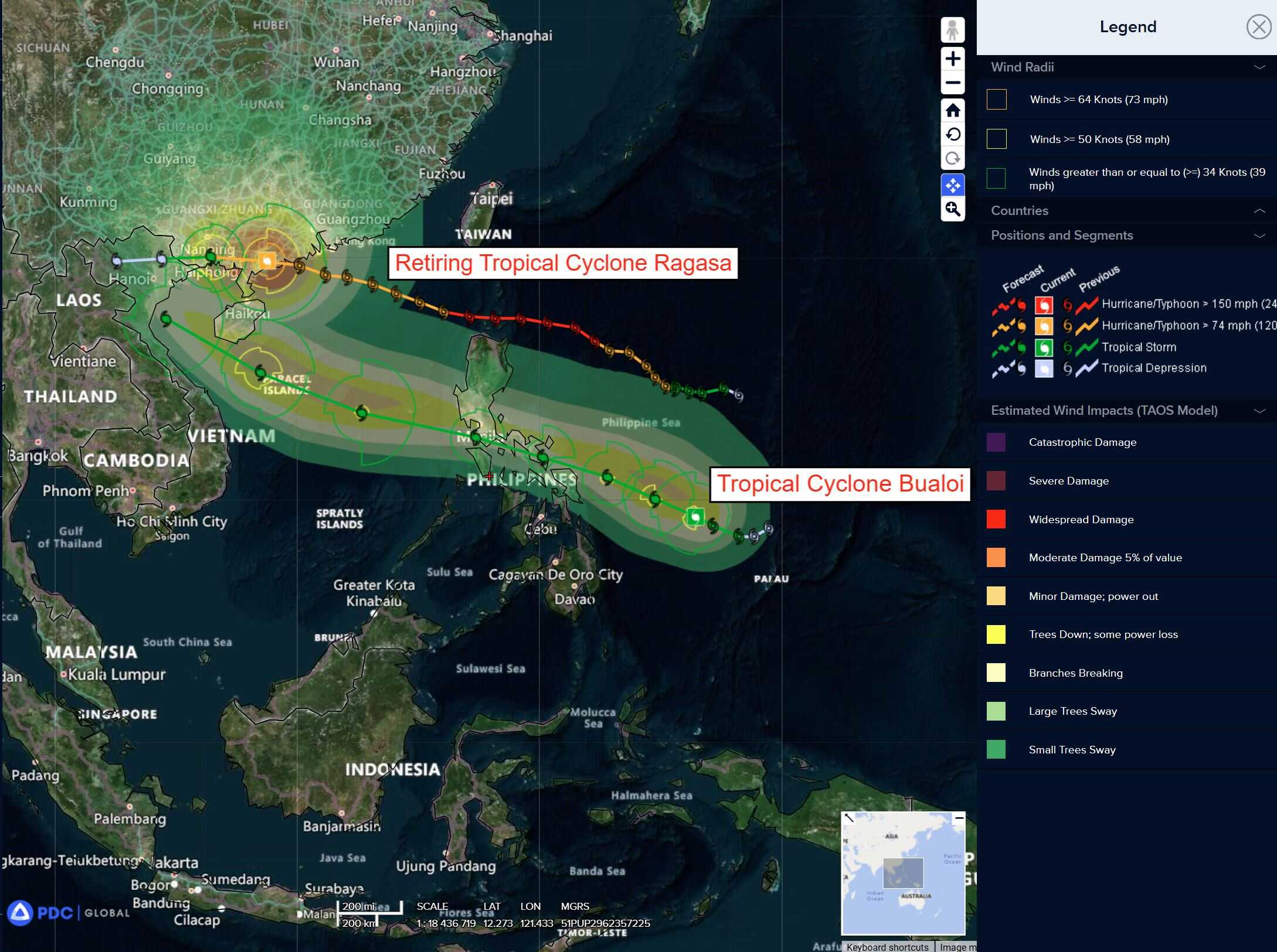
This marks the sixth tropical storm to develop in the South China Sea and Western Pacific during September, underscoring the region’s meteorological volatility. For residents and stakeholders, understanding such dynamic weather patterns becomes crucial for preparedness and risk mitigation. The potential for infrastructure disruption, travel complications, and safety challenges remains ever-present during tropical cyclone season.
Meteorological authorities emphasize the importance of continuous monitoring. While Bualoi’s exact impact remains uncertain, its proximity demands vigilance. The storm’s development could shift rapidly, potentially altering its projected path and intensity. Residents are advised to stay informed through official channels and remain prepared for potential weather-related contingencies.
The unfolding situation with Tropical Cyclone Bualoi exemplifies the complex and unpredictable nature of regional weather systems. Its emergence serves as a reminder of the delicate balance between atmospheric conditions and regional climate patterns. Each tropical cyclone represents a unique meteorological event, shaped by intricate interactions of wind, temperature, and oceanic dynamics.
As September progresses, southern China remains in a heightened state of weather awareness. The transition from Ragasa to Bualoi illustrates the region’s susceptibility to consecutive tropical systems, highlighting the need for robust meteorological tracking and community preparedness. While not every approaching storm will make direct landfall, the potential for significant disruption remains a constant consideration.
For now, eyes remain fixed on Bualoi’s trajectory, with meteorological experts carefully analyzing its potential path and intensity. The coming days will provide critical insights into whether this tropical storm will significantly impact Hong Kong and surrounding regions.