AI Weather Models Reveal Uncertain Storm Paths for Hong Kong
As the Hong Kong Observatory warns residents about potential weather disruptions next week, advanced artificial intelligence models are offering intriguing yet conflicting predictions about an approaching low-pressure system in the western North Pacific. The July 8, 2025 forecast highlights the complex challenge of predicting storm trajectories in an era of increasingly sophisticated meteorological technology.

Multiple AI-powered weather models are presenting different scenarios for how the developing storm might impact the region. The European Centre for Medium-Range Weather Forecasts Artificial Intelligence Forecasting System (ECMWF-AIFS) suggests the most direct and potentially concerning path, indicating the storm could approach Hong Kong directly. This projection raises immediate concerns about potential weather disruptions and safety risks for the city’s residents.
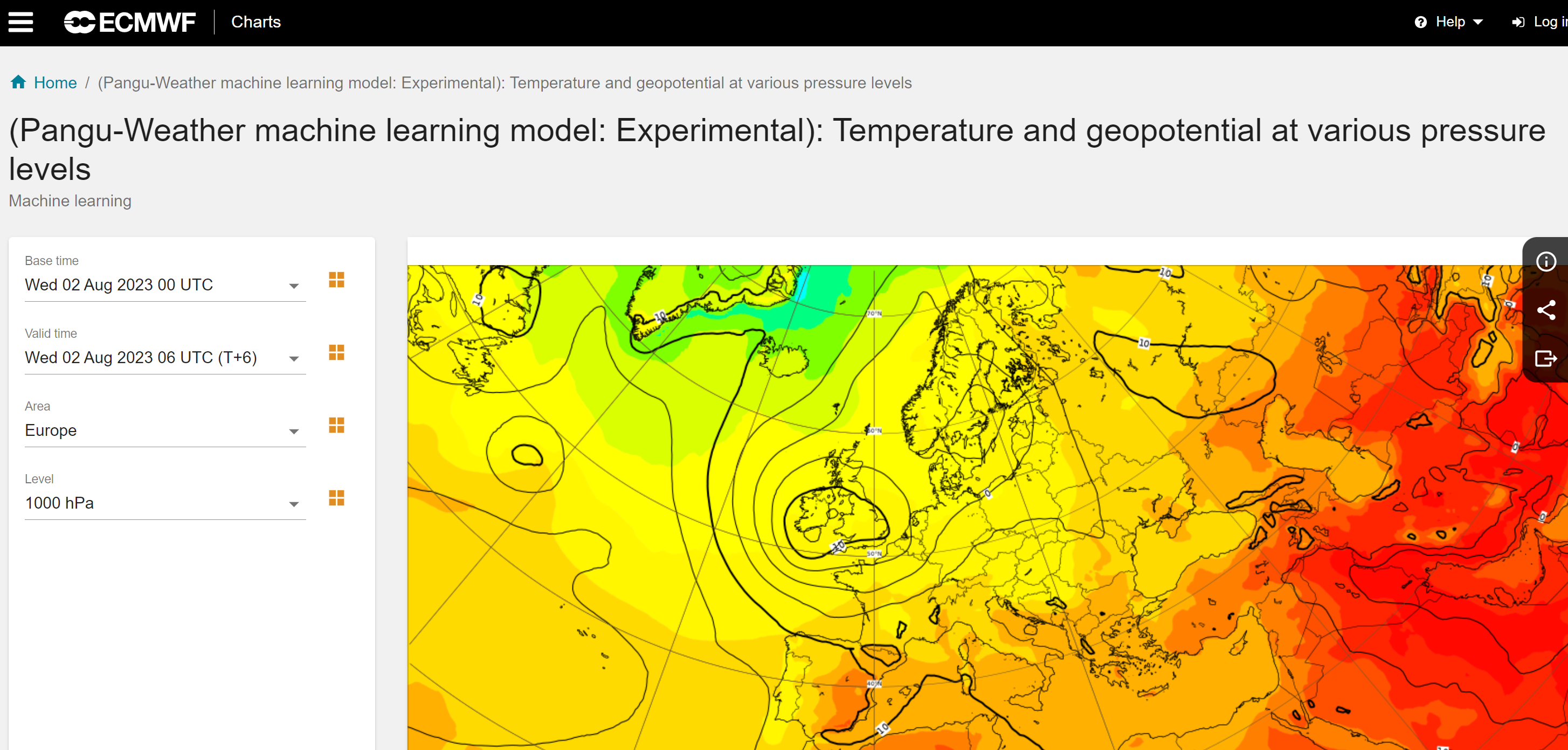
In stark contrast, other AI models paint a less alarming picture. The “Pangu” model predicts the storm might bypass Hong Kong entirely, instead making landfall near Zhanjiang. Meanwhile, the “Fengwu” model forecasts an even more eastward trajectory, suggesting the storm could move toward Shantou, which would significantly reduce the potential impact on Hong Kong.

These divergent predictions underscore the ongoing challenges in meteorological forecasting, even with cutting-edge artificial intelligence technologies. The Observatory has been transparent about the uncertainty surrounding the storm’s potential path and intensity, urging residents to remain vigilant and closely monitor updates.

The weather landscape becomes even more complex with an additional weather disturbance emerging near Luzon. This system is expected to enter the South China Sea within the next few days, potentially bringing scattered showers to the region. Simultaneously, an anticyclone moving northward suggests increased rainfall along the southern coast of China during the middle and latter parts of the upcoming week.
For Hong Kong residents, these forecasts mean preparing for potentially unsettled weather conditions. The combination of multiple weather systems creates an atmosphere of anticipation and uncertainty. The Observatory emphasizes the importance of staying informed through official channels and being ready for rapid weather changes.
The integration of AI models like ECMWF-AIFS, Pangu, and Fengwu represents a significant advancement in meteorological prediction. These technologies can generate multiple scenarios, providing meteorologists with more comprehensive insights than traditional forecasting methods. However, the current predictions also demonstrate that AI is not infallible, and discrepancies between models remain a critical consideration.
Residents are advised to take these forecasts seriously while maintaining a balanced perspective. The varying predictions do not mean the forecasts are unreliable, but rather highlight the inherent complexity of weather systems. Preparedness, staying informed, and having flexible plans are key strategies for navigating potentially challenging weather conditions.
As technology continues to evolve, these AI-driven weather models represent an exciting frontier in our understanding of atmospheric dynamics. While they cannot yet provide absolute certainty, they offer increasingly sophisticated tools for anticipating and preparing for potential weather events.
For now, Hong Kong stands ready, watching and waiting as these advanced AI models continue to refine their predictions, offering a glimpse into the future of meteorological forecasting.